


Binninea Loop Cullahill

mlmoroneybb
Gebruiker


--
Moeilijkheid : Medium

Gratisgps-wandelapplicatie
 SityTrail
IGN / Geografische instituten
SityTrail Plus
De wereld gaat voor u open
Over ons
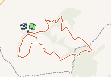
Tocht Stappen van 10,2 km beschikbaar op Onbekend, County Laois, The Municipal District of Borris-in-Ossory — Mountmellick. Deze tocht wordt voorgesteld door mlmoroneybb.
Beschrijving
Starting from the mapboard at the car park 2Km from village, follow the purple arrow downhill for 200m to reach a pathway on your right. Follow this pathway uphill for 500m to reach a stile and exit the woodland.
Plaatsbepaling
Opmerkingen